Looking for a specific Map of Frederick MD? Need a downtown Frederick map, a map of restaurants in Frederick, or a map of Frederick attractions? Or are you looking for a Frederick MD map for biking, hiking, or some other type of recreation?
This article pulls together all the best maps of Frederick to help you find the one you need. So read on to find your best Map of Frederick MD .
Find the Best Map of Frederick MD
Downtown Frederick Map for Shopping, Restaurants, Services, and Attractions
If you are looking for a map of Frederick, MD, for basic things like shopping, restaurants, services, bars, or breweries, there are some great options. This is especially true if you need a map of downtown Frederick to get ready to explore.
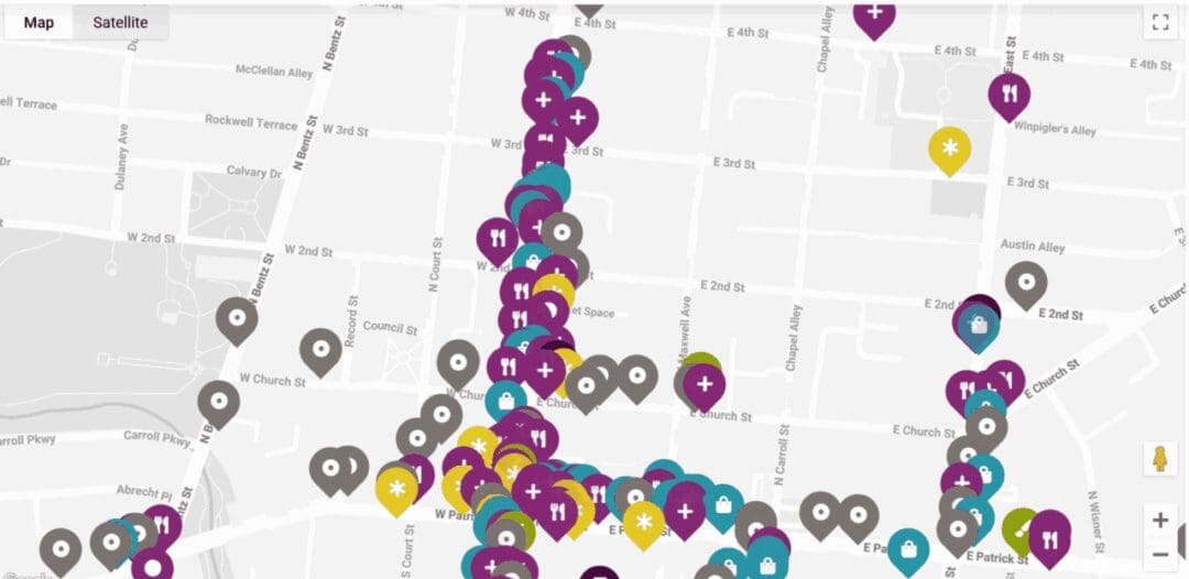
This is hands down the best Downtown Frederick Map if you are looking for shopping, services, restaurants, attractions, or art. Start and end with this Frederick Maryland map. (DowntownFrederick.org)
Downtown Frederick Shopping Map
Downtown Frederick Restaurants Map
Downtown Frederick Breweries Map
Wanderlog Frederick Best Restaurants Map
As an alternative, Wanderlog.com has a pretty extensive ranking and a map of the top 50 restaurants in Frederick. I’m not sure I would agree with their rankings, but it’s a useful map of Frederick restaurants and includes pretty much all the main establishments. (Wanderlog.com)
Share This Post :
The Best Frederick MD Parking Map
Frederick Parking Map – ParkFrederick
One of the things Nicole and I love about Frederick, especially downtown Frederick is the parking situation. Frederick not only has plenty of street parking (usually easy to find) but several downtown garages that are extremely inexpensive.
A site dedicated to Parking in Frederick has a great Frederick Parking Map. (ParkFrederick.org)
Frederick Handicap Accessible Parking Map
If you need a map for handicapped accessible parking in Frederick, the link above is a good one. (CityofFrederickMD.gov)
The Best Frederick MD Parks and Recreation Maps
The Frederick County, Maryland Geographic Information Systems (GIS) is a tremendous resource if you can find it, and had a lot of very useful maps of Frederick. This includes lots of maps focused on recreation and parks.
Frederick Interactive Parks and Recreation Map
This interactive GIS Frederick map allows you to find any park, facility, shelter, playground, or athletic field around Frederick. This is a super helpful resource with satellite images and links to more details for each facility. (FrederickCountyMd.gov)
The Best Frederick MD Hiking Maps
If you live in Frederick or are visiting, there are many great hikes in the area. Frederick is not far from the Appalachian Trail but is also close to many regional parks with great hiking (The Annapolis Rocks Trail is one of our favorites).
Frederick Interactive Hiking Trails Map
Frederick GIS also has a great interactive hiking trail map. This is a map for finding Frederick area hiking ideas, as you can explore all the hikes around Frederick organized by park.
Satellite images let you view them in more detail. However, it lacks more detailed information like ratings, difficulty, etc. (FrederickCountyMd.gov)
TrailLink Frederick Area Hiking Map
While you can search around and find a variety of Frederick hiking maps online, this is probably the best Frederick area hiking map.
TrailLink focuses on a slightly broader area (Maryland and beyond), but you can easily see a map of Frederick area hikes and then drill into the details of each to choose something perfect for you and your crew. (TrailLink.com)
Gaia GPS Best Hiking Trails Near Frederick
Another Frederick Hiking Map worth referencing is this one from Gaia. It has a great interactive map allowing you to review a long list of Frederick hikes and sort them by many criteria (length, difficulty, etc.).
Gaia is a GPS platform for hiking with paid offerings, but the free map is pretty good. (GaiaGPS.com)
The Best Frederick MD Biking Map
Frederick has a sneaky good biking scene, including lots of great mountain biking and single-track biking right in its backyard.
You can bike a long stretch of the C&O canal near Frederick and also visit great biking parks like Little Bennett and the Frederick Watershed.
Below are some Frederick Biking Maps to help you out.
TrailForks Frederick Biking Map
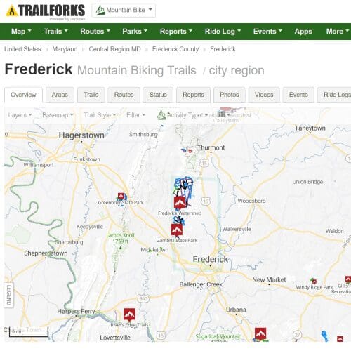
TrailForks is an Outside Magazine resource with maps for all kinds of outdoor activities. If you are an outdoor lover, this is a site you should familiarize yourself with.
This link shows a map that shows several of the options for mountain biking in the Frederick area.
Create an account, then you can access maps, photos, ratings, reports, and all kinds of other useful info. (TrailForks.com)
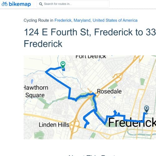
bikemap – Frederick Area Bike Map
bikemap is a crowdsourced website for bike route sharing. It’s a great resource for Frederick biking enthusiasts; you can see all the bike routes your fellow bikers have done in the area.
Create an account, then filter by the type of route you are looking for (city route, mountain bike route, road bike route). The most active bikers in Frederick share all the details including maps of the routes they’ve done. (bikemap.net)
The Best Frederick MD Property Maps and Frederick MD Neighborhood Maps
While I’m sure real estate professionals know of and use a long list of online maps for property and neighborhood research (many of them likely paid services), there are many Frederick property maps and Frederick neighborhood maps that are free and useful to almost anyone.
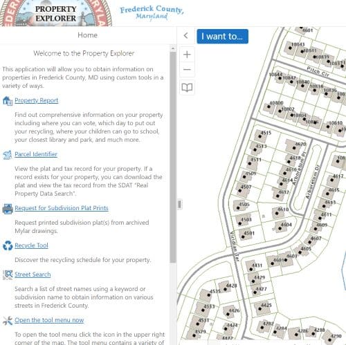
Frederick County Property Explorer
This highly informational resource is loaded with information about Frederick properties.
Want to know your voting districts, school districts, or recycling pick-up days? Use this tool to search for any property (by address or map exploration), and then get a detailed report.
Get plat and tax information for any property. Navigate streets and neighborhoods like Google Maps but with county property info linked. (FrederickCountyMd.gov)
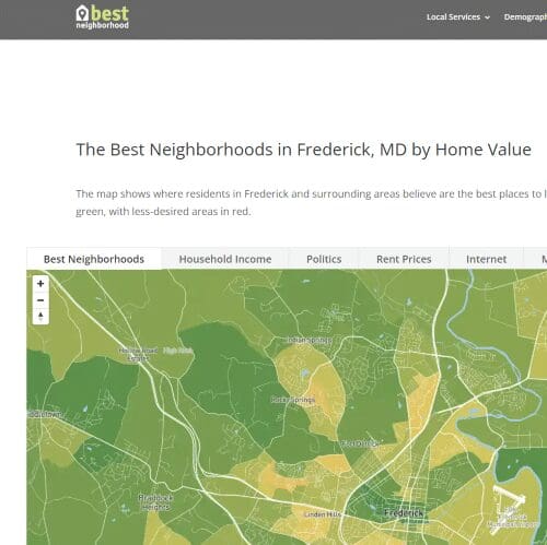
Best Neighborhood for Frederick MD
BestNeighborhood.org is another incredibly interesting site that maps of Frederick neighborhoods with various ratings and information.
See tabs for Frederick Neighborhoods maps coded by property value (‘desirability value’), household income, rent prices, even availability of broadband internet, and political leaning.
It’s stuff you’d think potential home buyers in Frederick would want to know. (BestNeighborhoods.org)
This map can help you find your school district or the school district for any address.
Frederick elementary schools, middle schools, and high schools are mapped for the region, and you can easily look them up by address. Or turn icons on/off for various types of schools in Frederick. (FrederickCountyMd.gov)
Best Frederick MD Road Closures Map and Frederick MD Snow Removal Map
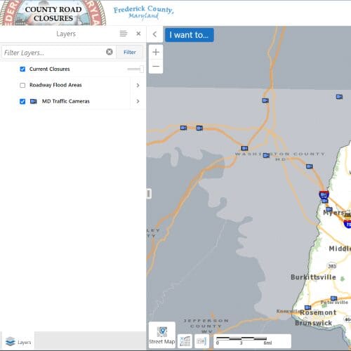
If you are a Frederick commuter, then there are some great maps to monitor road closures in the Frederick area.
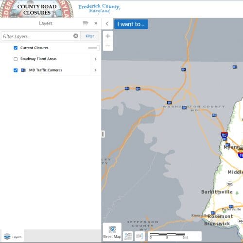
Finding a decent traffic map for Frederick is difficult (everyone has traffic apps on their phones). But the link above has real-time road closures for Frederick. (FrederickCountyMd.gov)
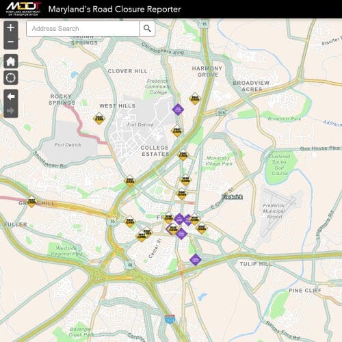
Frederick Road Closures Reporter
This is a similar road closures map from Maryland DOT, but you can drill into the Frederick area and get detailed road closure information around Frederick (there’s a lot!). (Roads.Maryland.gov)
Best Frederick MD Zoning Map, Frederick MD Development Map, and Frederick MD Planning Maps
If you are a professional real estate developer, navigating the various government websites for zoning, planning, and development probably comes naturally.
But your ordinary Frederick resident probably has no idea the very interesting maps available for browsing that detail all the Frederick Zoning, Frederick development plans, or Frederick commercial activity in the works.
Below are some very interesting maps.
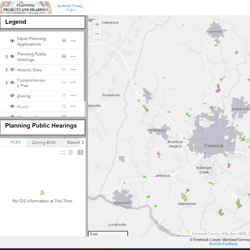
Frederick Projects Planning and Hearings Map
Want to see a map of all the applications for projects, zoning, and hearings scheduled? This map from the Frederick County government lets you see them all in map format and drill into the details of each application.
Get info on planning public hearings, zoning, historical sites, roads, etc. (FrederickCountyMD.gov)
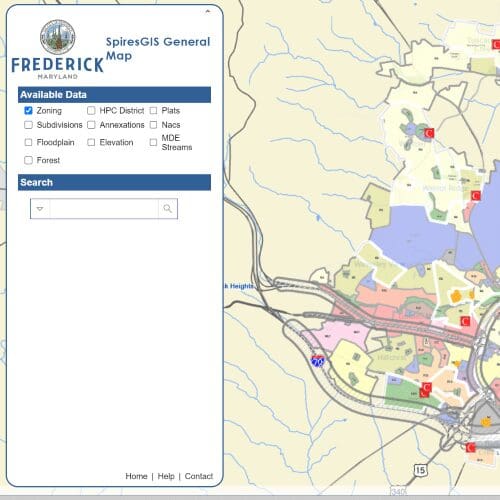
This incredibly detailed map shows how Frederick is Zoned. You can drill into all of Frederick and see not only the zoning but also Streetview and Google Map imagery.
Want to see how Frederick is divided into subdivisions? Get annexation or plat details? This map has this and lots of other detailed government information about property in Frederick. (CityofFrederick.gov)
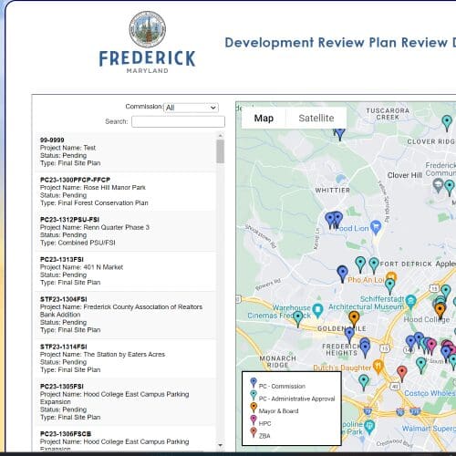
Frederick Development Review Map
This is a similar map but focused more on Frederick City. This Frederick Development Review map displays all the various plans and zoning projects around Frederick.
It’s quite fascinating if you want to research what some of the potential upcoming development plans are around Frederick. (CityofFrederick.gov)
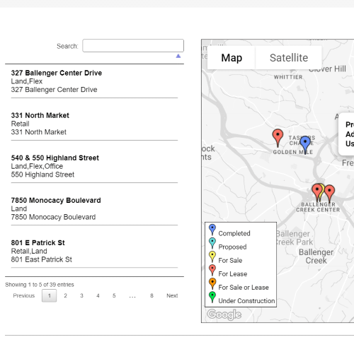
Frederick Commercial Development Map
This map highlights future commercial growth opportunities in Frederick. This map is part of an information source filled with strategic infrastructure investments around Frederick. (BusinessInFrederick.com)
Best Frederick MD Election Map
Election maps can be dizzying. They are detailed and ever-changing. But determining what county, legislative, and congressional district any given Frederick address is easier than ever.
Check out the links below for maps with Frederick election districts.
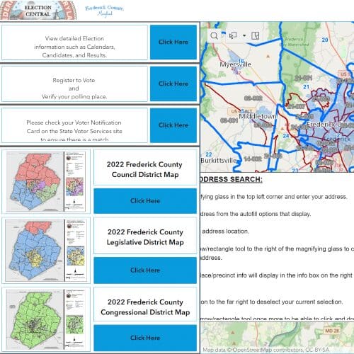
Frederick Interactive Election Map
This comprehensive Frederick election map is the best place to start for Frederick elections. You can see Frederick County Council Districts, Frederick County Legislative Districts, and Frederick County Congressional Districts.
In addition to surfing the map interactively, you can look up an address and get all the information for a single location.
This is also a great hub for other Frederick election info such as Frederick election calendars, Frederick candidates, and Frederick election results. (FrederickCountyMD.gov)
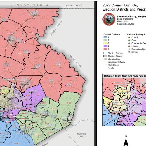
Frederick Council Districts, Election Districts, and Precincts
This map further details Frederick County and Frederick City Council Districts, Election District boundaries, Election Precincts, and Polling Places in Frederick County. (FrederickCountyMD.gov)
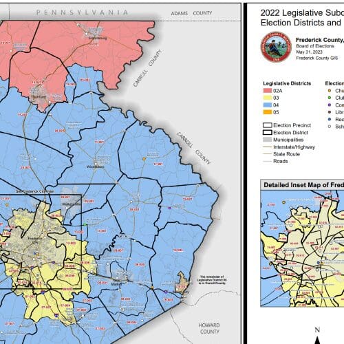
Frederick Legislative Districts Map
This maps Frederick Count Legislative Subdistricts, Election Districts, and Precincts. Here, you can see the color-coded mapping of the Frederick Legislative Districts, with additional information such as polling places. (FrederickCountyMD.gov)
Frederick County Congressional Districts Map
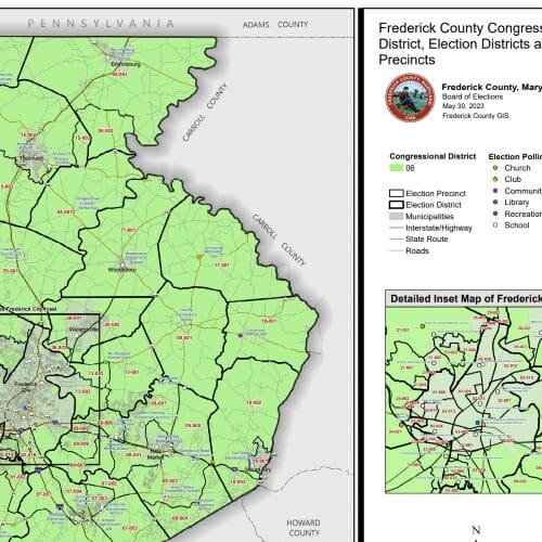
This link maps Frederick Count Congressional Districts, Election Districts, and Precincts.
Here, you see the boundaries of Maryland Congressional District 06 (including Frederick City), plus those for Election Districts and Election Precincts. You can also see information such as polling places. (FrederickCountyMD.gov)
Best Frederick MD Historical Maps
The city of Frederick has existed since ~1745, when it was a German settlement. Since then, it has had more than its fair share of history, as it has grown up with the State of Maryland and with the country in general.
Below are some interesting historical maps of Frederick.
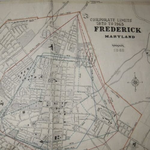
Frederick Corporate Limits Map (1870-1963)
This map shows how the corporate city limits of Frederick have grown over the years, from 1870 through 1963. (CityofFrederick.gov)
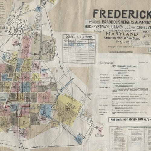
Sanborn Insurance Map of Frederick (1904)
Sanborn Insurance Map of Frederick (1930)
For years, the Sanborn Map Company published fire maps for insurance purposes, many of which are preserved in history books in the Library of Congress.
An intricate system of colors and symbols (used for specific insurance purposes) provides a very high level of detail about buildings and structures in Frederick as the time of map development. (CityofFrederick.gov)
Battle of Monocacy Civil War Map
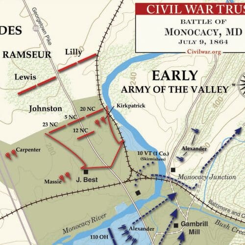
The Battle of Monocacy occurred just southeast of Frederick on July 9, 1864. It was significant for many reasons. It was the only Confederate victory on Union soil.
But it was also critical in slowing the advance of the Confederate Army’s march towards Washington. The Battle of Monocacy is one of Frederick’s most historic events. This map summarizes the action. (BattleFields.org)
Best Frederick MD Reference Maps
Below are a variety of other useful maps of Frederick, Maryland.
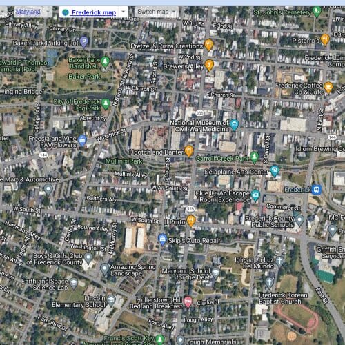
Satellites.pro has a very interesting and useful interactive map of Frederick that allows you to view a satellite map of Frederick and toggle to other maps.
You can view various Weather Maps of Frederick, Street Maps, and Temperature Maps and turn on/off icons for major places of interest. (Satellites.pro)
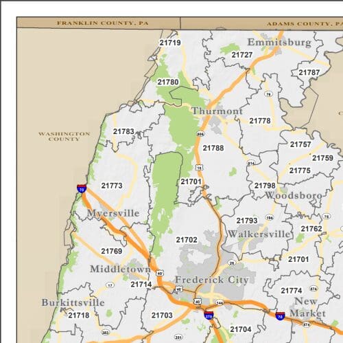
The link above is a map of zip codes in Frederick County. (FrederickCountyMd.gov)
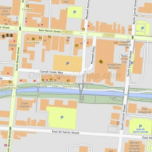
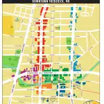
If you are looking for a basic, clean Frederick Downtown Map, this one from OnTheWorldMap.com is a good one.
A basic map of historic downtown Frederick MD with Frederick attractions labeled along with restaurants and shops. (OnTheWorldMap.com)
